Sale!
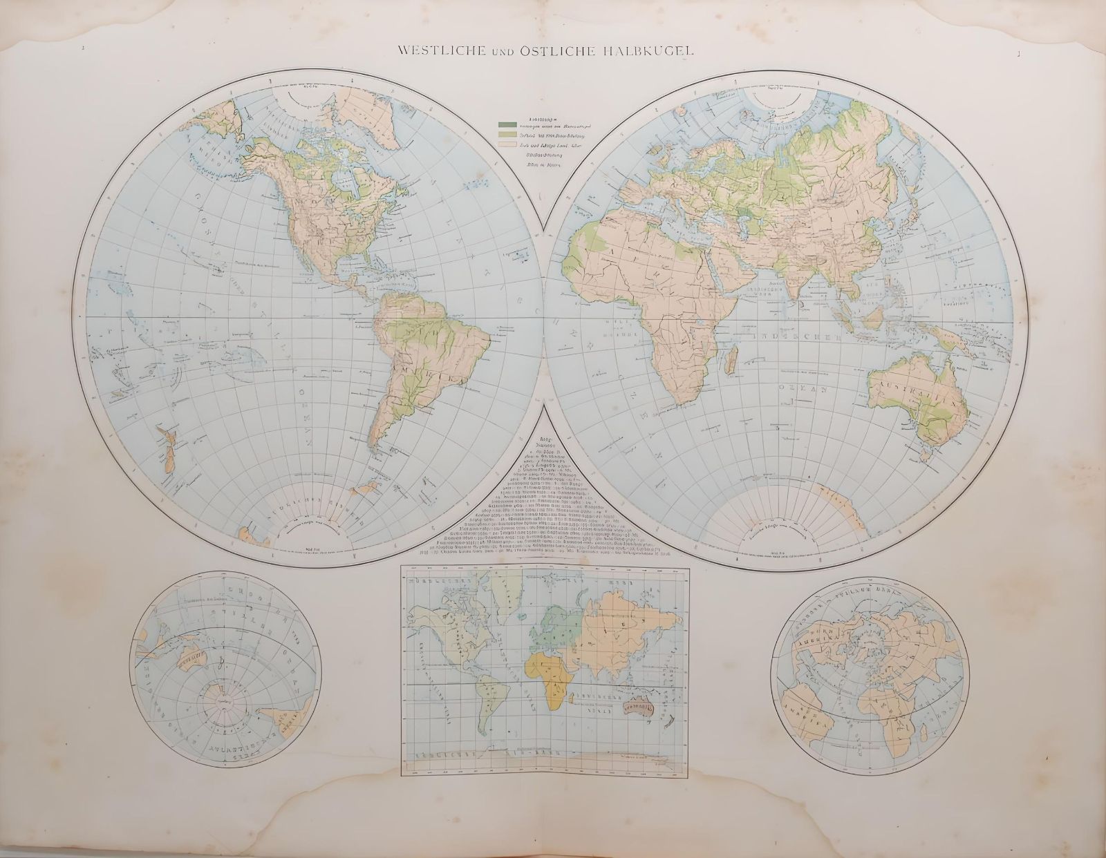
1887 Antique Map Western and Eastern Hemisphere
$ 46.32
Antique map of the North Pole region, titled on map Westliche und Ostliche Halbkugel. Three smaller maps on the bottom showing the world and views of the north and south pole areas. The map was originally published in 1887 as part of Andrees Allgemeiner Handatlas by Verlag von Velhagan and Klasing in Leipzig in Germany. The atlas was named after Richard Andre and was known for the quality of the maps and the printing technique they used, chromolithography. The 1887 edition was the 2nd release of the atlas. The maps is printed on card and is 42 by 55 cm’s with good margins for framing, map is a folding map with a centre line, these maps have a spine on the back which should be kept intact when framing, there are two other maps on the reverse. Map is in good condition for age, markings on paper, water mark on bottom near middle, please see pictures.
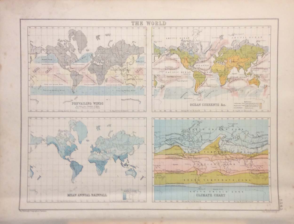
 The World in Hemispheres Map 1907
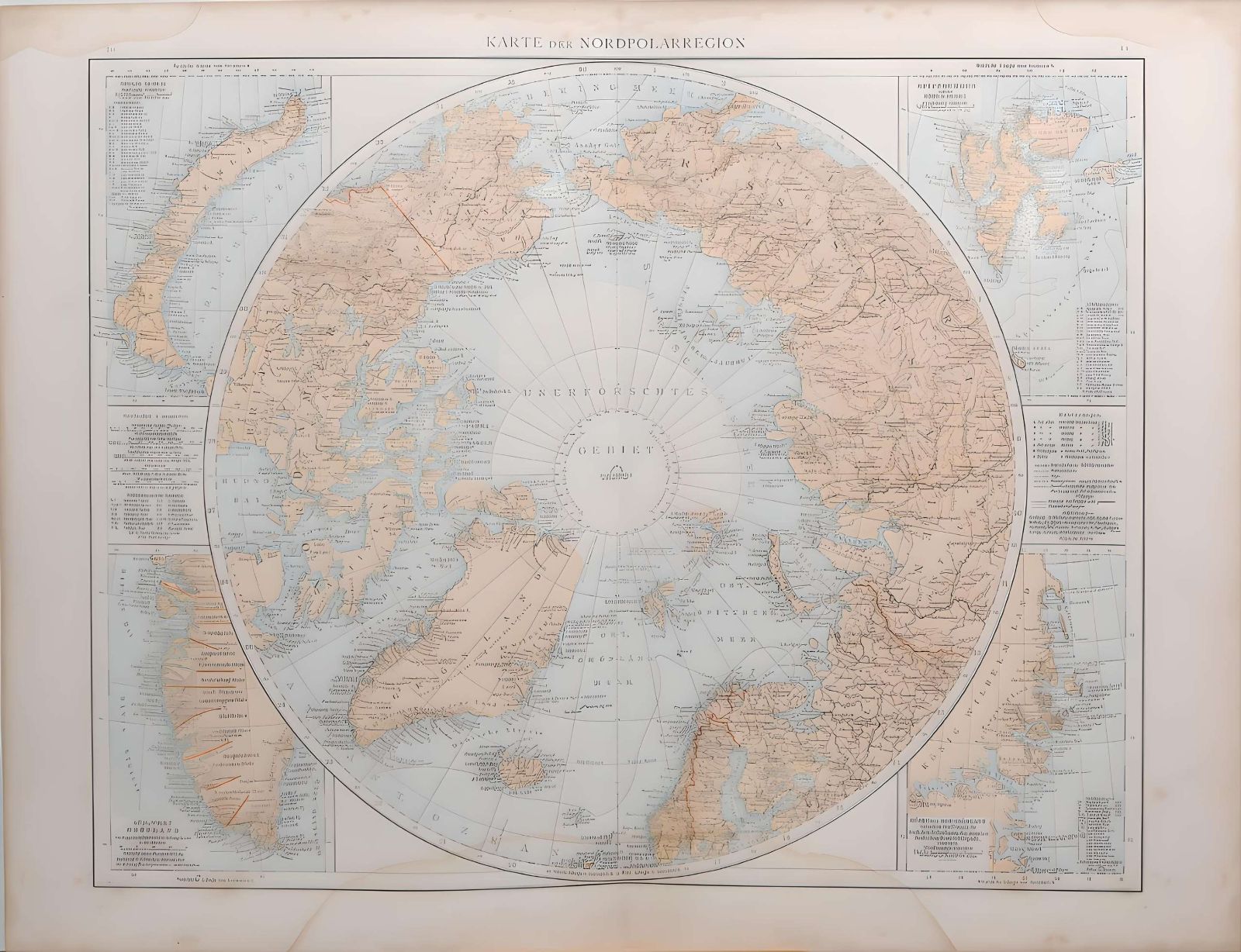
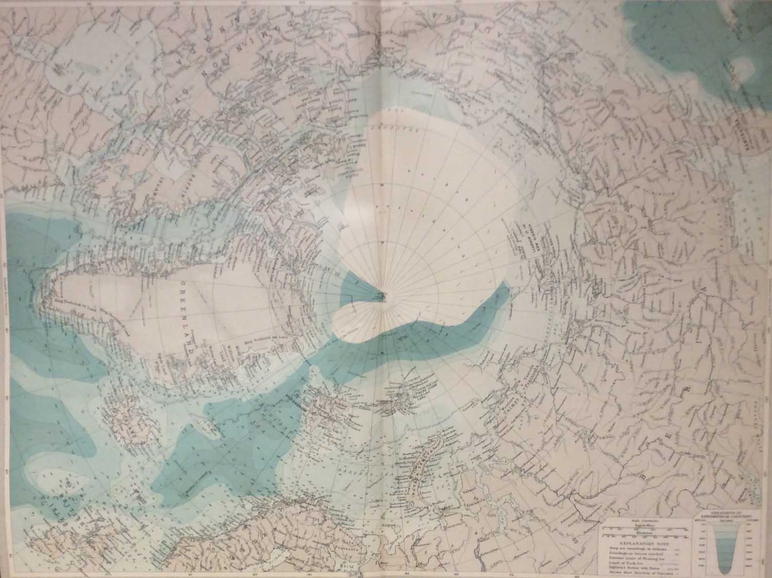 North Polar Region Map 1922 Vintage
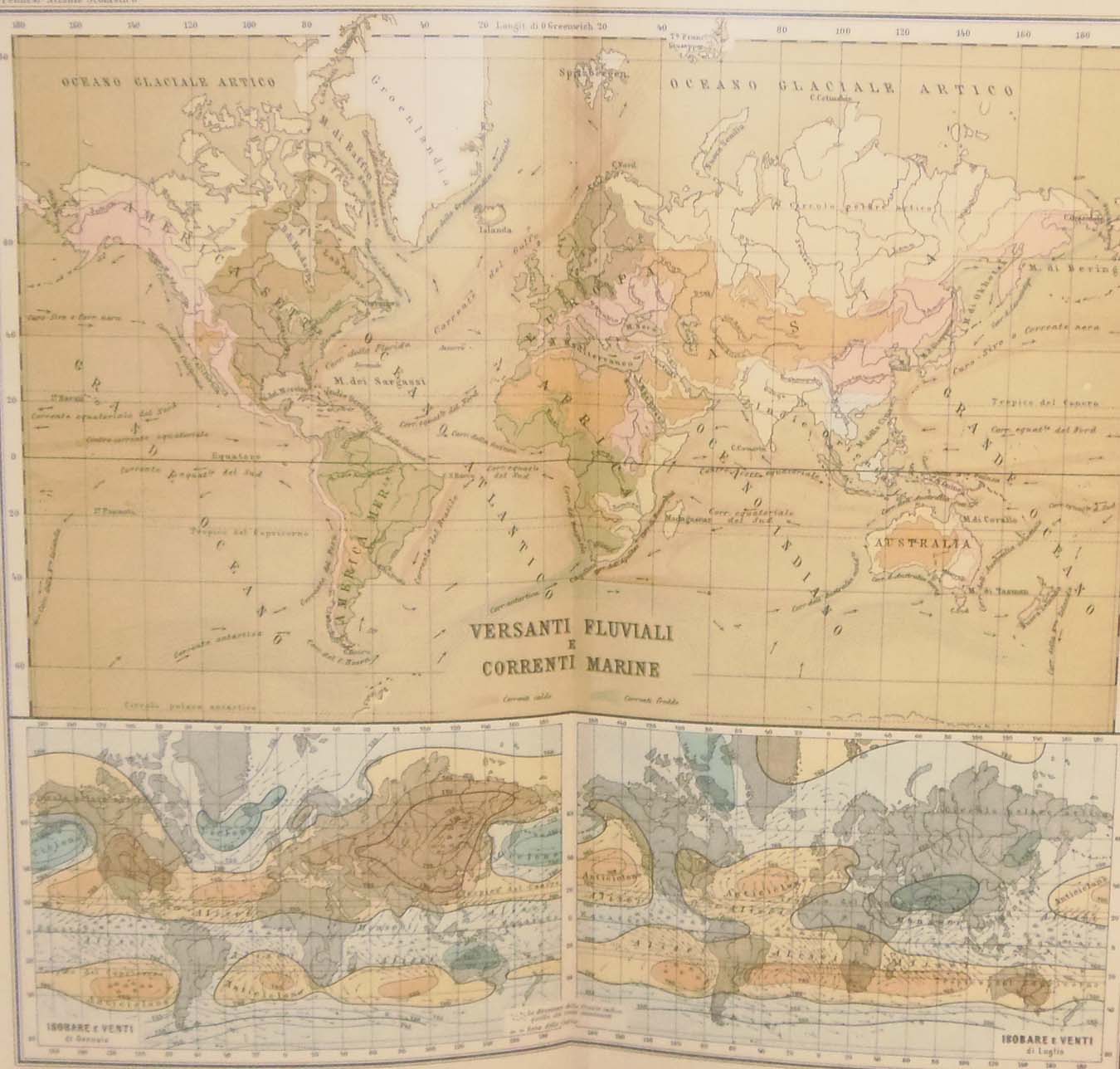 Antique Map World Marine Currents circa 1900
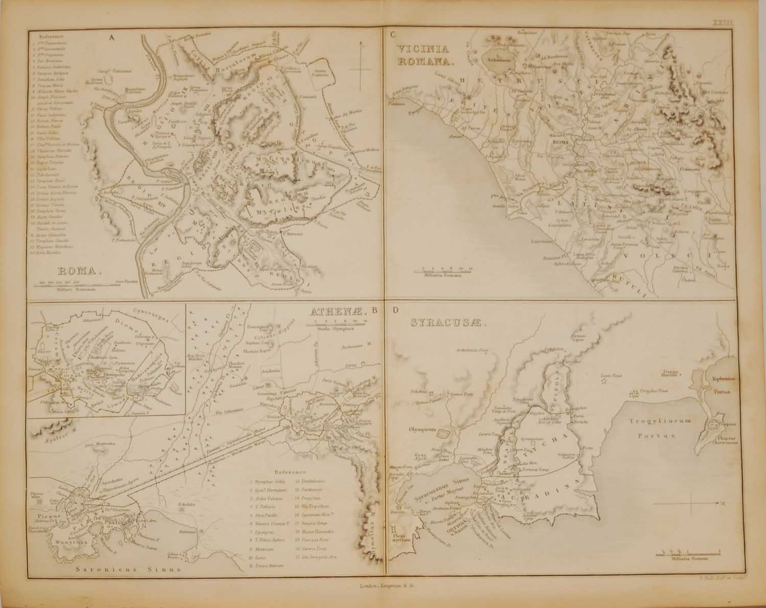 Antique Map 1851 Ancient Cities
 World Population Map 1922
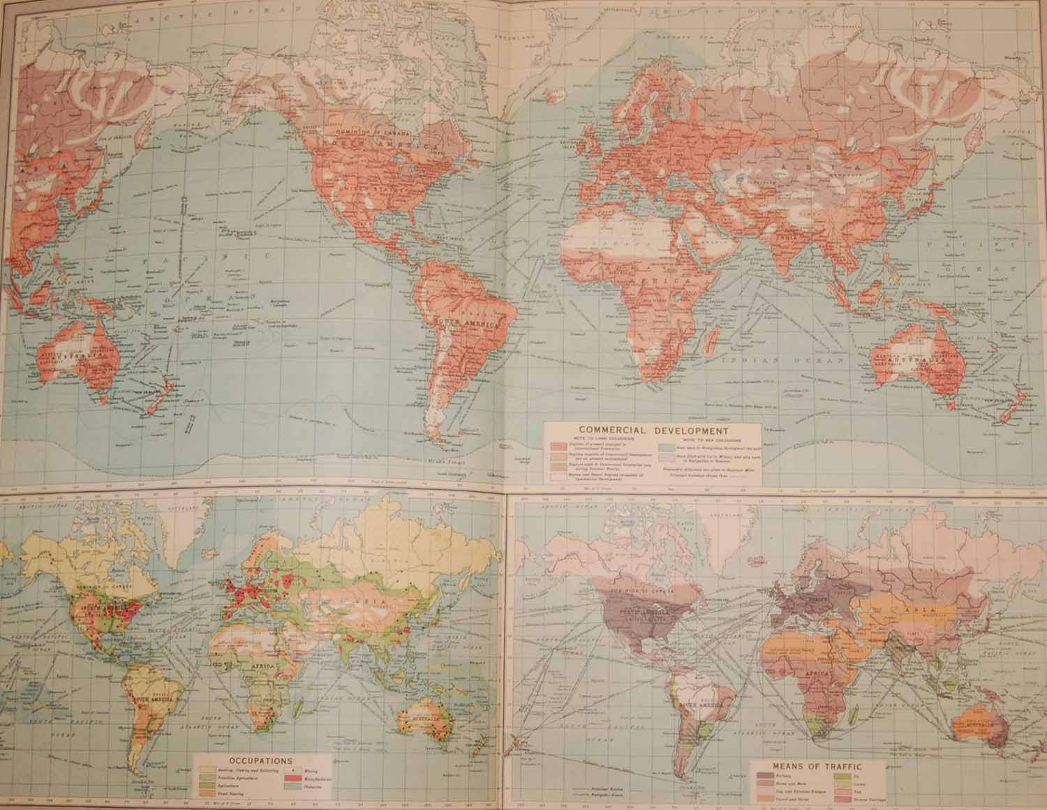
 1887 Antique Map Map of World Transport & Ocean Currents